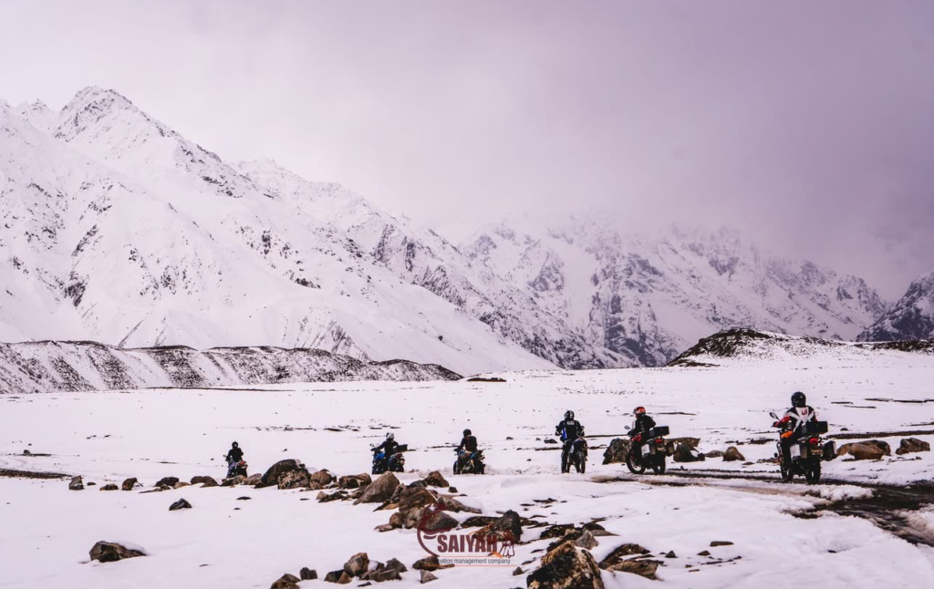
Shandur Pass is a broad, high plateau at roughly 3,700 metres (about 12,200 ft) on the road between Chitral and Gilgit-Baltistan in northern Pakistan. Travellers come for the open alpine scenery, the lakes and summer pastures, and above all the Shandur Polo Festival, held each summer on what is widely described as the world’s highest polo ground. The road over the pass is normally usable only in the warmer months, roughly June to early autumn, and conditions on both approaches change from year to year.
This guide explains where Shandur is, how to reach it from Gilgit and Chitral, when the road is realistically open, how festival travel differs from an ordinary visit, and how to plan the crossing by jeep or motorcycle. Where details change, such as festival dates and road works, we explain what to confirm before you leave.
Shandur Pass at a Glance
| Detail | What to Know |
| Elevation | About 3,700–3,800 m (12,200–12,500 ft); published figures vary |
| Location | Between Upper Chitral, Khyber Pakhtunkhwa, and the Ghizer area of Gilgit-Baltistan |
| Road | National Highway N-140 (Gilgit–Shandur–Chitral) |
| From Gilgit | About 212–216 km via Gakuch, Gupis and Phander |
| From Chitral town | About 153 km via Booni, Mastuj and the Laspur Valley |
| Usual road season | Roughly June to early October; snow usually closes or disrupts the pass from late autumn to late spring |
| Best known for | The Shandur Polo Festival, high-altitude lakes and open summer pastures |
Where Is Shandur Pass?
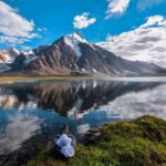
Shandur sits on the watershed between two valleys. To the east, the Ghizer River flows down through Phander and Gupis towards Gilgit. To the west, the Laspur River drops through Sor Laspur and Harchin to Mastuj in Upper Chitral. The pass is not a narrow notch but a wide, grassy plateau several kilometres across, with small lakes and a ring of Hindu Kush peaks.
Most sources put the top at around 3,700m gives 3,720 m (12,205 ft), the Khyber Pakhtunkhwa government has described the polo ground as being at about 12,200 ft, and some references round it to 3,800 m. Any figure in that range is reasonable. For planning, what matters is that you will be far higher than Gilgit or Chitral town.
The plateau lies on the line between Chitral and Gilgit-Baltistan, and the exact boundary has long been contested between the two regions. Some sources describe Shandur as being in Chitral, while others place it in Ghizer. It makes little practical difference to visitors, but it explains why Shandur carries so much pride on both sides.
Why Shandur Is Famous: Polo and the Shandur Polo Festival
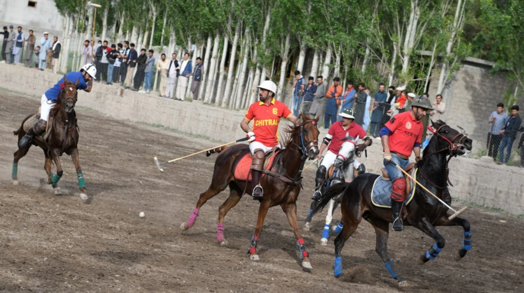
Shandur’s reputation rests on polo. Each summer, teams from Chitral and Gilgit-Baltistan meet on the Shandur polo ground in a tournament that draws thousands of spectators, many of whom camp on the plateau and watch from the surrounding slopes.
Freestyle Mountain Polo and a Long Rivalry
The game played here is the traditional freestyle polo of the northern mountains, faster and looser than the regulated international sport, with local bands playing through the match. The Chitral versus Gilgit-Baltistan contest is the heart of the event. Results are celebrated, and argued over, in both valleys long after the final whistle.
History: What Is Documented and What Is Tradition
Polo has deep roots in Chitral and Gilgit-Baltistan, and local stories of games on the Shandur plateau, including polo played by moonlight, go back generations. Many travel sites say the first organised tournament at Shandur took place in 1936 under a British political agent. The claim is widely repeated, but we could not find a primary source for it, so treat it as tradition rather than established fact.
Today, the festival is organised with the provincial tourism authorities, the Pakistan Army and local administrations.
Festival Dates
Many guides still say the festival runs from 7 to 9 July, but recent editions have been held earlier, in June. Dates are set each year by the Khyber Pakhtunkhwa and Gilgit-Baltistan governments and are usually confirmed only a couple of months ahead.
Check official announcements or ask a tour operator before booking anything.
Festival Week or a Quieter Visit?
| Factor | During the Polo Festival | Outside Festival Week |
| Atmosphere | Polo, music, dancing, cultural evenings and large crowds; organisers have also announced paragliding in recent years | Quiet plateau with herders, lakes and open views |
| Accommodation | Tent villages on the plateau; rooms in Phander and Mastuj fill early | Easier to find, but some places operate only seasonally |
| Roads | Much heavier traffic on narrow mountain roads | Light traffic, but fewer people around if you have a problem |
| Planning | Fixed dates; book camping and transport well ahead | Flexible within the open-road season |
Best Time to Visit Shandur Pass
| Period | Road Access | What to Expect |
| Late autumn to spring (roughly November–May) | Usually closed or unreliable because of snow | Snow-covered plateau; through travel generally not practical |
| June | Usually open, though snow can linger early in the month | Pastures turning green; recent festivals held this month |
| July–August | Generally open | Greenest and busiest period; heavy rain can cause floods and landslides on the approach roads |
| September–early October | Generally open | Fewer visitors and colder nights; autumn colour in the valleys below |
A seasonal window is not the same as confirmed access. Reopening dates vary with each winter’s snowfall, and in some years the road has reopened in spring, while summer storms can close it at short notice.
Monsoon floods have also washed away bridges on the Gilgit–Shandur road, cutting it off until the National Highway Authority restored access.
For a non-festival trip, late June to September usually offers the most dependable window, but check conditions in the days before you travel.
How to Reach Shandur Pass
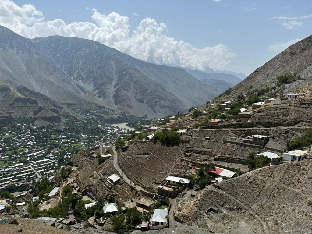
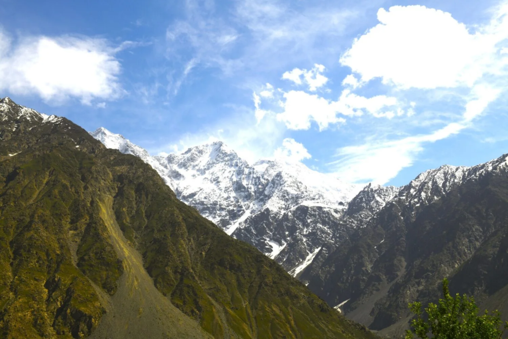
Shandur lies on the road between Gilgit and Chitral, so most visitors either cross it as part of a longer northern loop or approach from one side and return the same way.
From Gilgit: Via Gakuch, Gupis and Phander
The Gilgit–Shandur section of N-140 runs west for about 216 km along the Gilgit and Ghizer rivers, passing Gakuch, Gupis and the lakes around Khalti and Phander.
Gilgit-Baltistan’s tourism department puts Gupis to Phander at about 61 km. Beyond Phander, the road climbs past Teru and Barsat, the last villages on the Gilgit-Baltistan side, to the plateau.
Most travellers spend a night in Phander before the final climb, which breaks up the journey and allows time to adjust to the altitude.
From Chitral: Via Booni, Mastuj and Laspur
From Chitral town, the road follows the river north to Booni, turns east to Mastuj, then climbs the Laspur Valley through villages including Harchin and Sor Laspur to Shandur.
The National Highway Authority gives this route as about 153 km. The road is being rebuilt as part of N-140, with completion targeted for December 2026. That is a target rather than a guarantee, and some sections may still be unfinished after that date.
Until the work is complete, expect construction zones, diversions and surfaces that change from one season to the next.
From Islamabad
There is no direct route to Shandur Pass from Islamabad. You can travel north on the Karakoram Highway to Gilgit and approach from the east, or go via Dir and the Lowari Tunnel to Chitral and approach from the west.
Either route takes several days with overnight stops. Flights to Gilgit and Chitral can shorten the trip, but they depend on the weather and are often delayed or cancelled. Avoid building a tight schedule around them.
Route Comparison
| Approach | Approximate Distance | Usual Overnight Before the Pass | Notes |
| Gilgit side | 212–216 km from Gilgit | Phander | River and lake scenery; a gradual climb at the end |
| Chitral side | About 153 km from Chitral town | Mastuj or Booni | Road works underway; a steeper climb up the Laspur Valley |
| Full crossing, Gilgit to Chitral | About 365 km in total | Phander, then Mastuj or Booni | Best spread over two to three days |
Driving times depend heavily on road works, weather and traffic, so fixed hours can be misleading. As a rough planning guide, allow most of a day for either approach, and do not try to drive from Gilgit to Chitral in a single day.
Road Conditions and Driving Advice
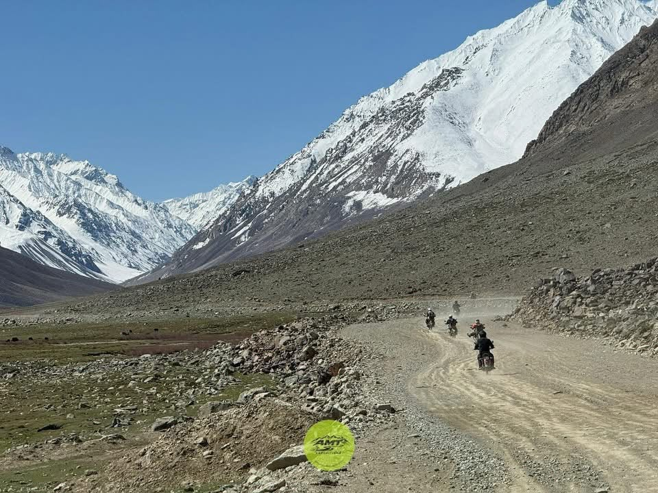
Expect a mixture of tarmac, gravel, construction diversions, stream crossings and stretches exposed to rockfall and landslides.
- A 4×4 or high-clearance vehicle with an experienced local driver is often the more suitable choice for these conditions.
- Set off early. Weather can worsen in the afternoon, and snowmelt may raise stream levels later in the day.
- Ask hotels, drivers and local checkpoints about closures each morning.
- Carry your ID. There are checkpoints along the route, and travellers report one near the top of the pass.
Sample Shandur Itineraries
Two- to Three-Day Crossing
- Day 1: Travel from Gilgit to Phander via Gakuch and Gupis, with the evening at Phander Lake.
- Day 2: Cross Shandur Pass from Phander to Mastuj or Booni, with time on the plateau for photos and a walk by the lakes.
- Day 3: Continue to Chitral town, then visit the Kalash valleys or travel south via the Lowari Tunnel.
The same plan works in reverse from Chitral. If you want to see sunrise or sunset on the plateau, arrange a camp or simple guesthouse stay in advance.
Festival Trip
Plan three to four nights on or near Shandur. Arrive the day before the matches begin to settle into camp and adjust to the altitude, stay through the final, and leave the next morning before the rush.
For readers who prefer an organized route, two Saiyah tours cross Shandur between Phander and Booni as part of longer northern loops.
One is the Three Mighty Combo motorcycle tour, a 16-day loop through Deosai, Skardu, Hunza, Shimshal and Chitral. The other is the 17-day 4×4 self-drive tour across the Karakoram, Himalaya and Hindu Kush.
Shandur Pass on a Bike Tour
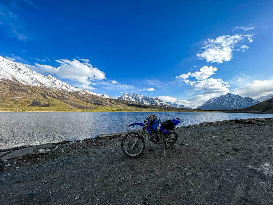
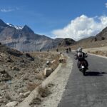
The Shandur crossing is a standout day on many northern Pakistan motorcycle routes. After long stretches in narrow river valleys, the road climbs onto a wide, high plateau of grassland, lakes and grazing yaks, with snow peaks on every side.
The riding on the plateau itself is relatively gentle; the harder work is on the climbs at either end.
The Approaches
From the Gilgit side, the ride follows the Ghizer River past Gupis and the lakes around Phander before climbing through Teru and Barsat to the plateau.
From the Chitral side, the climb from Mastuj up the Laspur Valley is steeper and more enclosed until it opens out at the top. Either direction works, but it is best to start the pass day early from an overnight stop close to the climb.
Road Surfaces, Bikes and Rider Experience
The road conditions described above matter more on two wheels. Loose gravel, ruts, construction diversions and meltwater crossings can be challenging for riders.
A dual-sport or adventure motorcycle with good ground clearance and tyres suited to gravel will cope far better than a road bike, but no motorcycle guarantees an easy crossing in poor conditions.
You should be confident on gravel, in water crossings and on steep descents before attempting Shandur without a guided group.
Daily Distances and Overnight Stops
- Gilgit to Phander: about 190 km, a full riding day.
- Phander to Booni over Shandur: about 125 km, a full day given the surfaces and stops. Mastuj is a shorter alternative.
- Booni or Mastuj to Chitral town: a shorter day on the improving N-140.
These distances come from Saiyah’s own route itineraries and are approximate. Riding times vary with road works and weather, so treat each stage as a full day and avoid night riding.
Fuel Planning
Do not expect fuel on the plateau. Fill up in the last larger town before the climb on either side, and ask locally which pumps further along the route are operating.
Supplies in remote areas can be disrupted. If your bike has a short range, carry a small reserve in an approved container.
Riding Gear and Tools
- Full riding gear with armour, plus a waterproof outer layer
- Warm gloves and thermal layers under your riding gear
- Waterproof boots suitable for stream crossings
- Puncture repair kit, tyre levers and a compact pump
- Basic tools, plus spare levers, cables and fuses
- Offline maps, a power bank, a first-aid kit and, if you have one, a satellite messenger
Altitude, Remoteness and Safety
- Altitude: Spending the night in Phander or Mastuj before crossing gives you more time to adjust. Watch yourself and other riders for headache, unusual fatigue or poor coordination.
- Remoteness: Medical help can be hours away. Ride within your limits and keep the group together, with a rider at the back.
- Insurance: Make sure your policy covers motorcycling, the engine size you are riding, and the altitude involved.
Riding During the Polo Festival
Festival week means heavy jeep and bus traffic, dust and slow-moving queues on narrow sections, which can be tiring on a motorcycle. Outside festival dates, the crossing is usually calmer.
If you ride in for the polo, allow extra time for each riding day.
Riders who would rather not organise bikes, fuel and logistics themselves can join AMT Expeditions’ 16-day North Pakistan Circuit Ride. The tour crosses Shandur from Phandar to Booni and includes a motorcycle with fuel and gear, an English-speaking rider guide and a luggage support vehicle for groups of four or more. Check the tour page for current departures.
Where to Stay and Camping
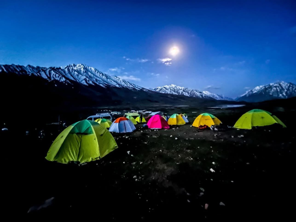
- On the plateau: Seasonal camping and very basic accommodation, plus official and private tent villages during the festival.
- Gilgit side: Phander has guesthouses and campsites and is the most popular base. Teru and Barsat have limited options.
- Chitral side: Mastuj and Booni have guesthouses and small hotels, while Chitral town has more choice.
Before you leave, confirm that your accommodation is open for the season, whether blankets or heating are provided, and whether meals are included.
Weather, Altitude and What to Pack
Summer days on Shandur can be sunny and pleasant, but the weather changes quickly, the wind is often strong and nights are cold. We have not found reliable long-term temperature records for the plateau, so pack for anything from warm sun to freezing nights rather than relying on an average.
Unacclimatised travellers are at risk of altitude illness when sleeping at about 2,450 m (8,000 ft) or higher, according to the CDC Yellow Book.
Shandur is well above that height, though most visitors pass over it in a few hours or spend only a night or two. Sleeping lower down first, drinking enough water and taking it easy on arrival can help.
Severe headache, confusion, loss of coordination or breathlessness at rest are warning signs. Descend and seek medical help if they occur. Anyone with heart or lung conditions should talk to a doctor before travelling.
Packing Checklist
- Warm insulated jacket, fleece and thermal base layers
- Waterproof, windproof outer shell
- Warm hat and gloves, plus a sun hat
- Sunglasses and high-SPF sunscreen, because UV is strong at altitude
- A sleeping bag rated below freezing if you are camping
- Sturdy walking shoes
- Personal medication and a basic first-aid kit
- Headtorch, power bank and offline maps
- Enough cash for the whole trip
- Water bottle and snacks for long travel days
Cash, Mobile Signal and Food
Cash: Do not rely on ATMs beyond Gilgit or Chitral town. Carry enough Pakistani rupees for fuel, food, accommodation and emergencies.
Mobile signal: Coverage on the approaches is patchy, and storms can knock it out for days. Download offline maps and leave your route with someone at home.
Food: Simple meals are available in villages on both approaches, and stalls appear during the festival. Outside festival time, bring snacks and water for the plateau.
Responsible Travel and Photography
Shandur’s light is best early in the morning and late in the evening. At the festival and in villages, ask before photographing people, especially women, and accept a refusal gracefully.
- Take all your rubbish with you, because there is no regular waste collection on the plateau.
- Keep vehicles and bikes on existing tracks to protect the grassland.
- Slow down for herders and give way to livestock.
- Dress modestly and follow local customs in villages.
- Spend locally on guesthouses, shops, drivers and guides.
Before You Go: Checks and Common Mistakes
- Festival dates: Use the latest official announcement, not dates from an old blog post.
- Road status: Check both approaches in the days before travel, and again each morning.
- Accommodation: Confirm bookings, especially during festival week.
- Spare days: Landslides and floods can stop traffic without warning, so build at least one spare day into your plan.
- Fuel and cash: Fill up and withdraw money in the larger towns.
Plan Your Northern Pakistan Journey with Saiyah
Shandur fits naturally into a wider journey that combines the Ghizer Valley, Chitral and the Kalash valleys. Saiyah runs motorcycle tours in northern Pakistan and tours in Chitral and the Kalash valleys.
If you want a route built around your own dates, whether for the festival, a road crossing or a longer loop, you can request a customized itinerary or contact the Saiyah.
Frequently Asked Questions About Shandur Pass
Where is Shandur Pass located in Pakistan?
Shandur Pass is in northern Pakistan, between Upper Chitral in Khyber Pakhtunkhwa and the Ghizer district of Gilgit-Baltistan. It lies on the N-140 route connecting Gilgit and Chitral and is known for its high-altitude landscapes and traditional polo festival.
How high is Shandur Pass above sea level?
Shandur Pass is approximately 3,700 metres (12,200 feet) above sea level, although published elevations vary slightly. Due to the high altitude, visitors should prepare for cold temperatures, strong winds and possible altitude-related symptoms.
What is the best time to visit Shandur Pass?
The best time to visit Shandur Pass is generally from June to September, when the mountain route is more likely to be accessible. June and July are popular for the Shandur Polo Festival, while later summer can be suitable for travellers seeking quieter landscapes. Always check current road and weather conditions before travelling.
When is the Shandur Polo Festival held in Pakistan?
The Shandur Polo Festival is traditionally held in summer, with recent editions taking place in June, although older schedules often list early July. The dates can change each year, so check official announcements from the relevant authorities before booking your trip.
How do you travel to Shandur Pass from Gilgit or Chitral?
From Gilgit, the route to Shandur Pass is approximately 216 km via Gakuch, Gupis and Phander. From Chitral, the route is approximately 153 km via Booni, Mastuj and the Laspur Valley. Travel times depend on road conditions, weather and stops, so many visitors break the journey overnight in Phander or Mastuj.
Is Shandur Pass open throughout the year?
No. Shandur Pass is usually accessible during the summer season, roughly from June to early October, depending on snow and road conditions. Heavy snowfall can close the route in winter and spring, while landslides, flooding and road damage may cause temporary closures during summer.
Can you go camping at Shandur Pass?
Yes, camping is possible on the Shandur plateau during the warmer months, and temporary tent accommodation is commonly arranged during the polo festival. Nights can be extremely cold even in summer, so bring a warm sleeping bag, insulated clothing and weather-resistant camping equipment.
Can you ride a motorcycle to Shandur Pass?
Yes, Shandur Pass can be included in a northern Pakistan motorcycle tour. A suitable adventure or dual-sport motorcycle, experience riding on gravel and rough mountain roads, and careful fuel planning are recommended. Riders should check road conditions before departure and allow extra time for weather-related delays.
How many days do you need to visit Shandur Pass?
Allow at least two to three days for a journey between Gilgit and Chitral via Shandur Pass, including overnight stops and sightseeing. A trip focused on the Shandur Polo Festival may require three to four nights in the area. Extra days are advisable because mountain weather and road closures can affect travel plans.
What should you pack for a trip to Shandur Pass?
Pack warm layers, a waterproof and windproof jacket, gloves, a warm hat, sturdy footwear, sunglasses, sunscreen, personal medication, a first-aid kit and offline maps. Carry enough cash because card payments and mobile connectivity may be limited. If camping, bring a sleeping bag suitable for below-freezing temperatures.