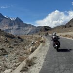
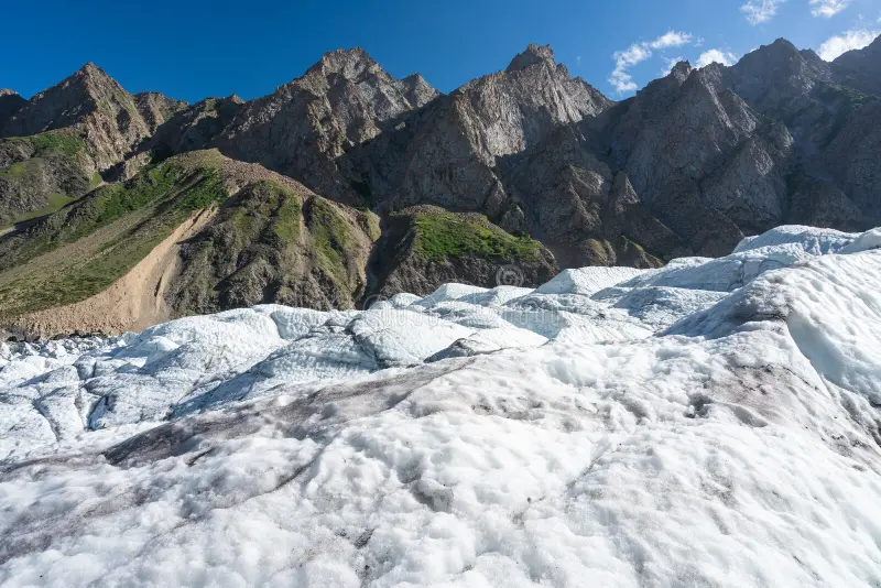
If you have seen the Passu Cones from the Karakoram Highway and wondered what lies beyond them, the Patundas Trek takes you deeper into that landscape.
Located in Gojal, Upper Hunza, Patundas is a high-altitude meadow surrounded by glaciers and some of the most impressive mountains of the Karakoram. The trek begins around Borith Lake and leads through summer pastures, rugged mountain trails and the Passu Glacier before climbing toward Patundas.
At around 4,200 metres, Patundas offers the feeling of a serious Karakoram trek without requiring weeks in the mountains. It is a particularly good choice for travellers who want to combine a Hunza tour with a few days of trekking and camping.
This guide covers the Patundas Trek route, altitude, difficulty, best season, camping, glacier conditions and a practical itinerary.
Patundas Trek Pakistan: Location, Altitude, Difficulty, Route & Best Time
| Information | Details |
| Location | Gojal, Upper Hunza, Pakistan |
| Mountain range | Karakoram |
| Starting area | Borith Lake |
| Patundas altitude | Around 4,200 m |
| Main route | Borith Lake → Passugar → Passu Glacier → Luzhdar → Patundas |
| Difficulty | Moderate to challenging |
| Trekking duration | Around 3 to 5 days |
| Best season | June to September |
| Accommodation | Camping |
| Main highlights | Passu Glacier, Patundas Meadows, Karakoram mountain views |
Patundas Location in Upper Hunza
Patundas is located in Gojal, Upper Hunza, in the Gilgit-Baltistan region of northern Pakistan.
The trekking area sits high above Passu and Hussaini, between the Passu and Batura glacier systems. Most journeys begin near Borith Lake, which can be reached from the Karakoram Highway.
The usual approach follows:
Islamabad → Gilgit → Hunza → Gulmit → Hussaini/Borith Lake → Patundas
This accessibility is one of the advantages of the trek. You can leave the Karakoram Highway and, within a relatively short time, find yourself walking through a remote high-mountain environment.
Landscape of the Patundas Trek
Hunza is famous for Karimabad, Attabad Lake, Hussaini Bridge and the Passu Cones, but Patundas shows a much wilder side of the valley.
The scenery changes constantly as you gain altitude.
The cultivated villages of Gojal gradually disappear below. Dry mountain slopes lead toward summer pastures, followed by moraine and glacial terrain. Higher up, the landscape opens into the broad alpine surroundings of Patundas.
The trek combines several of Upper Hunza’s most interesting natural features in one journey:
- Borith Lake
- Passugar summer pasture
- Passu Glacier
- High-altitude camps
- Patundas Meadows
- Panoramic Karakoram views
It is short enough to fit into a wider Hunza itinerary but adventurous enough to feel like a proper mountain journey.
Borith Lake and the Trailhead
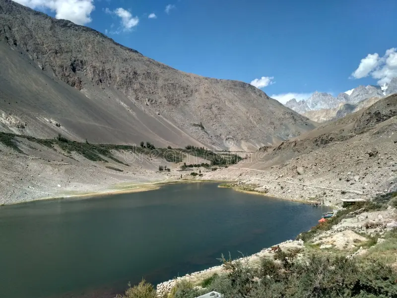
Borith Lake, near Hussaini, is commonly used as the starting area for the Patundas Trek.
The lake sits above the Karakoram Highway in a quiet basin surrounded by barren mountains. It is also visited by migratory birds at certain times of the year.
From Borith, the trail begins climbing away from the inhabited valley toward Passugar.
The change happens quickly. Roads and villages become smaller behind you, while the mountain landscape becomes increasingly dominant.
Passugar Summer Pasture
The trail continues toward Passugar, a traditional summer pasture above the valley.
High pastures have long been part of life in Gojal. During the warmer months, local communities have traditionally moved livestock into higher grazing areas, making these landscapes part of the region’s living pastoral culture.
Passugar also marks the approach toward the Passu Glacier.
From here, the trek begins to feel noticeably more remote, with fewer signs of permanent settlement and increasingly dramatic views across the surrounding mountains.
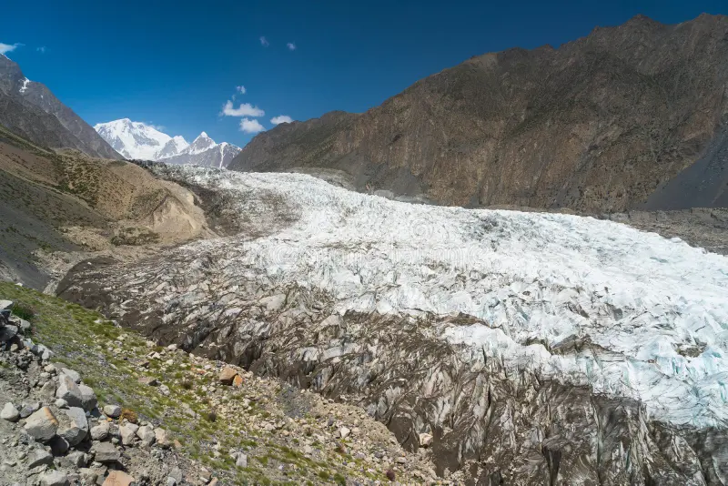
Passu Glacier Crossing
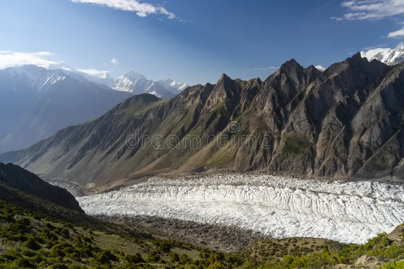
The Passu Glacier crossing is one of the most adventurous sections of the Patundas Trek.
Walking across glacial terrain is very different from following an ordinary mountain path. The surface can include loose rock, ice, meltwater channels and crevasses.
More importantly, a glacier is constantly moving.
A route used during a previous trekking season may not be the best route today. Conditions can also change during the summer as temperatures and meltwater levels vary.
For this reason, trekkers should not depend entirely on old GPS tracks or online route descriptions. An experienced local guide who knows the current glacier conditions is strongly recommended.
Crossing the glacier also provides one of the most memorable perspectives of the journey. Here, you are no longer simply looking at the Karakoram. You are walking through the landscape that defines it.
Luzhdar Camp
After the glacier section, the trail continues toward Luzhdar, one of the main camping areas below Patundas.
By this stage, the villages of Upper Hunza feel far away.
The surroundings are dominated by mountain walls, glacier systems and open terrain. There are no hotels or conventional tourist facilities here, so camping becomes an essential part of the experience.
Luzhdar also provides a useful overnight stop before the final climb toward Patundas.
Patundas Meadows
The climb from Luzhdar leads toward the Patundas Meadows, at approximately 4,200 metres above sea level.
This is the highlight of the trek.
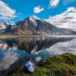
After the rougher terrain below, Patundas opens into a broad high-altitude landscape surrounded by glaciers and snow-covered mountains.
Do not expect the lush green fields of lower Hunza. Patundas is an alpine environment where patches of pasture sit among rock, ice and enormous mountain ridges.
Its position between the Passu and Batura glacier systems gives the area an extraordinary sense of scale.
Camping here also means you experience the landscape after the day’s trekking is finished. Sunset, a clear night sky and the first light over the surrounding peaks can easily become some of the most memorable moments of the journey.
Mountain Views from Patundas
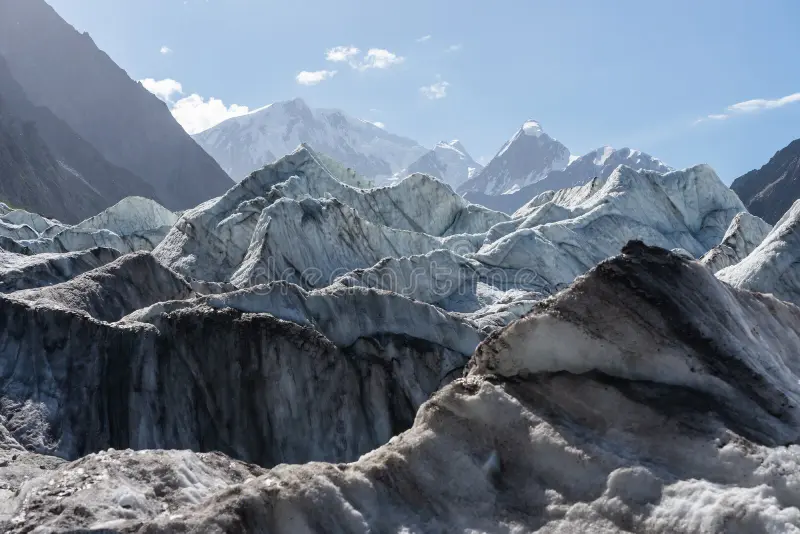
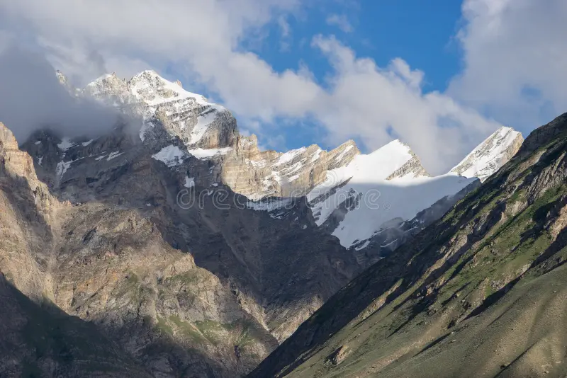
Patundas is known as one of the finest high viewpoints in Upper Hunza.
On a clear day, the surrounding panorama can include major Karakoram peaks such as:
| Mountain | Elevation |
| Batura Sar | 7,795 m |
| Shispare | 7,611 m |
| Passu Sar | 7,478 m |
| Momhil Sar | 7,343 m |
| Tupopdan, Passu Cones | 6,106 m |
The wider landscape includes numerous other peaks and ridges belonging to the Batura Muztagh.
Visibility naturally depends on the weather. Early mornings are often particularly rewarding for photography before clouds begin building around the mountains.
Patundas Trek Altitude and Acclimatization
Patundas reaches approximately 4,200 metres, while the Borith Lake area is around 2,600 metres.
That is a significant gain in altitude over a relatively short distance.
The trek should therefore not be rushed.
Spending a few days exploring Hunza before starting the trek gives your body more time to adjust. Karimabad, Gulmit, Passu and other parts of Upper Hunza can easily be incorporated into the journey before heading into the mountains.
At higher elevations, walk at a comfortable pace, drink enough water and pay attention to how you feel.
Headache, nausea, dizziness, unusual fatigue and loss of appetite can be signs of altitude sickness. Symptoms should never be ignored simply to continue an itinerary.
All images used in this article are sourced from Dreamstime.
Patundas Trek Difficulty
The Patundas Trek is best described as moderate to challenging.
Technical mountaineering experience is not normally required for the standard trekking route, but this is not an easy sightseeing walk.
Trekkers should be comfortable with:
- Several hours of walking
- Steep ascents and descents
- Loose rock and moraine
- Glacier terrain
- High altitude
- Camping
- Cold mountain conditions
Reasonable fitness and some previous hiking experience will make the trek much more enjoyable.
The combination of altitude and glacier terrain is more important than the total number of kilometres. A shorter day at 4,000 metres can feel considerably harder than a longer walk at lower elevation.
Patundas Trek Route
The commonly used route follows:
Borith Lake → Passugar → Passu Glacier → Luzhdar → Patundas Meadows
| Trek stage | Approx. elevation | Landscape |
| Borith Lake | ~2,600 m | Lake and mountain basin |
| Passugar | ~3,200 m | Summer pasture |
| Passu Glacier | Varies | Glacier and moraine |
| Luzhdar | ~3,400 to 3,600 m | High mountain camp |
| Patundas | ~4,200 m | Alpine meadow and viewpoint |
Routes, crossing points and exact camping locations can change according to current trail, weather and glacier conditions.
Patundas Trek Itinerary
Day 1: Hunza to Borith Lake
Travel through Upper Hunza toward Hussaini and Borith Lake.
The first day can be kept relatively relaxed, allowing time to organize trekking equipment, meet the local team and explore the lake surroundings.
Overnight: Borith Lake
Day 2: Borith Lake to Luzhdar
Begin trekking from Borith toward Passugar.
Continue toward Passu Glacier and cross the glacial terrain with your guide before reaching the camping area around Luzhdar.
This is one of the most varied days of the trek, moving from dry mountain trails into the glacier environment.
Overnight: Camp at Luzhdar
Day 3: Luzhdar to Patundas
Climb from Luzhdar toward Patundas Meadows.
The altitude makes the ascent demanding, so a steady pace is important.
As you gain height, the surrounding mountains and glacier systems gradually open around you.
Reach Patundas and spend the remainder of the day exploring the viewpoints and enjoying the high-mountain surroundings.
Overnight: Camp at Patundas
Day 4: Patundas to Luzhdar
Wake early for sunrise and clear mountain views before beginning the descent.
Return toward Luzhdar and camp for another night.
Overnight: Camp at Luzhdar
Day 5: Luzhdar to Borith Lake and Hunza
Continue back across the Passu Glacier and descend through Passugar toward Borith Lake.
Meet the vehicle and return to Passu, Gulmit, Karimabad or your next destination in Hunza.
The itinerary should always remain flexible. Weather, glacier conditions and the pace of the group can affect walking times.
Best Time for Patundas Trek
The main season for trekking to Patundas is from June to September.
June brings early summer conditions and fewer trekkers, although snow may remain higher on the route.
July and August are generally the warmest months and the main trekking season in Upper Hunza.
September can bring crisp mountain views and quieter trails, but nights become noticeably colder.
Even in midsummer, weather at 4,200 metres can change quickly. Warm clothing and protection from wind and rain are essential throughout the season.
Camping and Trekking Facilities
Patundas is a camping trek.
Once you leave the inhabited areas, there are no conventional hotels, restaurants or shops. Food, tents and other essential equipment need to travel with the trekking party.
A properly organized trek typically requires:
- Sleeping tents
- Suitable sleeping bags
- Camping mattresses
- Cooking equipment
- Food supplies
- Water treatment
- First-aid supplies
- Porter support where required
The basic facilities are part of the experience. Patundas is rewarding precisely because you leave the developed parts of Hunza behind.
Packing for Patundas Trek
Mountain conditions can change quickly, so pack for both strong sunshine and cold weather.
Bring comfortable trekking boots with good ankle support, trekking trousers, base layers, a fleece, insulated jacket and waterproof outer layer.
A warm hat and gloves are useful even during summer.
Sunglasses and sunscreen are particularly important at altitude, especially around snow and glacier surfaces.
Trekking poles can make the steep and uneven sections easier, while a headlamp, reusable water bottle, power bank and personal medication should also be carried.
Most importantly, use boots you have already walked in. A glacier trek is not the place to break in new footwear.
Local Guides and Glacier Safety
Local knowledge matters on Patundas.
The glacier is constantly changing, and crossing points can shift between trekking seasons. Meltwater, ice conditions, moraine and crevasses can all influence the route.
An experienced guide can assess current conditions rather than relying on where the trail used to be.
Local support also makes camping logistics considerably easier and provides valuable knowledge about water sources, weather, grazing areas and the surrounding mountains.
Wakhi Culture and Gojal
The Patundas Trek passes through Gojal, a region closely associated with the Wakhi communities of Upper Hunza.
Life here has historically been shaped by the mountain environment. Villages occupy the lower valleys, while high pastures have traditionally been used for seasonal livestock grazing.
Walking through these areas adds a cultural dimension to the trek.
The landscape may look like wilderness to a visitor, but many of these pastures have been connected to local communities for generations.
Respect livestock, grazing grounds, shelters and water sources along the route.
Responsible Trekking
Patundas remains a relatively undeveloped mountain environment, and keeping it clean requires effort from everyone who visits.
Carry plastic, batteries and other non-biodegradable waste back to the valley. Avoid leaving rubbish at campsites or contaminating water sources.
Use established camping areas where practical and avoid unnecessary damage to alpine vegetation.
A simple rule works well here: everything you carry into the mountains should come back with you unless it is safely biodegradable.
Patundas Trek With Saiyah Travel
A trek like Patundas becomes much easier when the transport, camping equipment, guides and mountain logistics are organized before you arrive.
Saiyah Travel organizes Patundas Trek tours and customized journeys through Hunza and northern Pakistan. Depending on your itinerary, arrangements can include private transportation, local trekking guides, camping equipment, meals, porters and accommodation before and after the trek.
You can book Patundas as a dedicated trekking trip or combine it with Karimabad, Attabad Lake, Gulmit, Hussaini, Passu and Khunjerab Pass for a more complete Hunza experience.
Planning to trek Patundas? Contact Saiyah Travel to build a private or customized Patundas Trek itinerary based on your travel dates, group size and preferred pace.
Final Thoughts
Patundas is one of those places that explains why people come to Hunza for sightseeing and return for trekking.
The journey begins close to the Karakoram Highway, but within a few days you are camping at around 4,200 metres with glaciers below and some of the Karakoram’s great mountains filling the horizon.
That contrast is what makes the Patundas Trek in Pakistan so rewarding.
It is accessible without feeling ordinary, challenging without requiring a long expedition, and remote enough to show you a side of Hunza that cannot be experienced from the road.
If your journey to Hunza is about getting closer to the mountains rather than simply seeing them, Patundas deserves a place on your itinerary.
Frequently Asked Questions About Patundas Trek
Where is the Patundas Trek located in Pakistan?
Patundas Trek is located in Gojal, Upper Hunza, in Gilgit-Baltistan, northern Pakistan. The usual trekking route begins around Borith Lake near Hussaini and Passu before continuing into the high mountains of the Karakoram.
What is the altitude of Patundas Meadows?
Patundas Meadows are located at approximately 4,200 metres above sea level. The exact elevation varies slightly depending on the campsite or viewpoint, so trekkers should allow enough time to acclimatize before reaching the highest part of the trek.
How many days does the Patundas Trek take?
The Patundas Trek usually takes around 3 to 5 trekking days, depending on the itinerary, walking pace, weather and glacier conditions. Spending additional time in Hunza before the trek is useful for acclimatization.
How difficult is the Patundas Trek in Hunza?
Patundas is a moderate to challenging high-altitude trek. Trekkers should be prepared for steep climbs, rough mountain trails, loose moraine, glacier terrain, camping and several hours of walking at high altitude.
What is the best time for the Patundas Trek?
The main trekking season for Patundas is from June to September. July and August generally offer warmer summer conditions, while June and September can be cooler. Mountain and glacier conditions should always be checked before departure.
Does the Patundas Trek cross the Passu Glacier?
Yes. The standard Patundas route includes the Passu Glacier area, making glacial terrain one of the highlights of the trek. Glacier conditions and crossing points can change, so current conditions should always be assessed locally.
Do you need a guide for the Patundas Trek?
An experienced local guide is strongly recommended for the Patundas Trek. Local knowledge is particularly valuable around the Passu Glacier, where terrain and crossing conditions can change, as well as for campsites, water sources and mountain logistics.
Can beginners do the Patundas Trek?
Fit beginners with previous hiking experience can consider the Patundas Trek with proper acclimatization and experienced local support. However, its altitude, rough terrain and glacier sections mean it should not be treated as an easy first hike.
Do you need to camp on the Patundas Trek?
Yes. Patundas is primarily a camping trek because there are no conventional hotels or guesthouses on the higher sections of the route. Tents, sleeping equipment, food and other trekking supplies need to be carried with the group.
Can I book a Patundas Trek tour from Hunza?
Yes. Patundas can be arranged as a dedicated trek or combined with a wider Hunza tour covering Karimabad, Attabad Lake, Gulmit, Hussaini and Passu. Saiyah Travel can arrange a customized Patundas Trek with local guides, transport, camping equipment, meals and trekking support according to the itinerary.