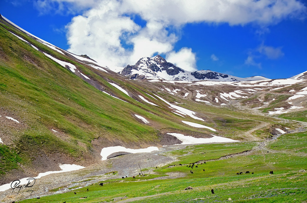
Burzil Pass is a historic high-altitude mountain pass in Astore District, Gilgit-Baltistan. It rises to 13,808 feet, or 4,198 metres (approximately 4,200 metres), and is known for its open alpine landscape, remote mountain road and important place in the history of travel between Kashmir and Gilgit.
Long before modern highways reached northern Pakistan, Burzil formed part of one of the main routes between Srinagar and Gilgit. Traders, officials, couriers, travelers and pack animals once crossed these mountains. Today, visitors approach the pass from Astore through Gorikot and Chilam, while the road continues toward Minimarg where current access arrangements permit.
For travelers, Burzil offers more than a scenic mountain drive. Its combination of history, high-altitude scenery and connection with the wider Astore and Deosai region makes it one of the more interesting routes in this part of Gilgit-Baltistan.
Burzil Pass at a Glance
| Detail | Information |
| Location | Astore District, Gilgit-Baltistan |
| Elevation | 4,198 m (approximately 4,200 m), 13,808 ft |
| Main route | Astore → Gorikot → Chilam → Burzil Pass |
| Astore to Chilam | Approximately 53 km |
| Beyond Burzil | Minimarg and Domel, subject to current access conditions |
| Astore to Minimarg | Around 4 to 5 hours by jeep |
| Best time | July and August |
| September | Often possible depending on weather |
| Recommended vehicle | High-clearance 4×4 |
| Main considerations | Altitude, road conditions, weather and access restrictions |
Burzil Pass Location and Geography
Burzil Pass lies in southern Astore District, close to the administrative boundary between Gilgit-Baltistan and Azad Jammu and Kashmir.
The Gilgit-Baltistan Tourism Department places the pass around 5 km north of the GB-AJK administrative boundary and approximately 30 km north of the Line of Control. It also identifies the western slopes of the pass as a source area of the Astore River.
The usual modern approach is from Astore through Gorikot and Chilam before climbing toward Burzil. From the pass, the road continues toward Minimarg and Domel where access is permitted.
Historically, the route continued farther toward Kashmir. Burzil is not an open international border crossing today.
Burzil Pass Elevation
The official Gilgit-Baltistan Tourism Department lists Burzil Pass at 13,808 feet. The official Astore tourism map gives a more precise metric figure of 4,198 metres, which can be rounded to approximately 4,200 metres.
At this altitude, travelers may notice the effects of thinner air. Temperatures can also change rapidly, especially when wind, cloud or rain moves across the pass.
Spending some time at a lower elevation in Astore before traveling higher can make the journey more comfortable.
The History of Burzil Pass
Burzil’s history is one of the strongest reasons to visit the area.
Before modern road links connected Gilgit with the rest of Pakistan, the old Gilgit road approached from Kashmir. Historical route guides show travelers moving through the Gurez area, then through settlements around Peshwari and Minimarg before reaching Burzil and descending through Chilam toward Astore.
A tourist guide published in 1896 records the route from Gurais through Poch-twari, Burzil Chauki, Chellan, Godhai and Astore. A later route description published in 1940 gives an even clearer sequence from Gurais to Peshwari, then through Minimarg to Burzil Chauki, over Burzil Pass to Chilam, and onward toward Godhai and Astore.
These records also show that Burzil was connected with the route toward Skardu and the Deosai Plains. The 1940 description specifically notes that the Deosai route toward Skardu diverged from the Burzil Chauki area.
During British rule, the road became strategically important for communication between Kashmir and Gilgit. Travelers, officials, soldiers, pack animals and supplies moved through this corridor.
The Gilgit-Baltistan Tourism Department records another interesting detail. By the early twentieth century, a hut had been built at the crest of Burzil Pass to serve as a relay point for couriers carrying mail and messages between British India and areas farther north.
The existence of such shelters is also supported by historical photographic records. The British Library catalogue contains a photograph taken in May 1918 titled “Burzil Chowki bungalow, Kashmir,” showing a bungalow surrounded by snow.
Otto Honigmann’s 1911 Crossing
One of the better documented early twentieth-century journeys across Burzil was made by German traveler Otto Honigmann.
Museum Fünf Kontinente records that Honigmann travelled through Kashmir, Ladakh and Baltistan in 1911 and 1912, leaving behind around 200 photographs as well as letters documenting his journey. The museum’s publication and archive preserve this material.
His letters describe difficult conditions around Burzil in early October 1911. Heavy snow made progress difficult, his ponies could not continue safely, and porters were eventually brought in to help the party cross. His photographs include views of the Burzil area during the first snowfall of the season.
These records help show how demanding the route could be before modern road access. Burzil was not simply a scenic pass. It was part of a difficult but important mountain communication route.
After the political changes following the 1947-48 conflict, the old through-route toward Kashmir stopped functioning in its former role.
Today, travelers visiting Burzil are following part of a road that once connected Gilgit with Kashmir and formed an important part of regional travel and communication.
Burzil Pass Road Trip: Astore Route Guide
Astore is the main starting point for visiting Burzil Pass.
From Astore town, the road continues through the valley toward Gorikot and then Chilam. The official Astore tourism map gives the distance from Astore to Chilam Chowki as approximately 53 km.
From Chilam, the route toward Burzil separates from the road leading into Deosai.
This distinction is useful when planning a combined trip. If you visit Burzil and then want to continue toward Deosai and Skardu, you generally return toward the Chilam junction before taking the separate Deosai road.
Astore to Minimarg via Burzil
Minimarg lies beyond Burzil Pass in a greener and more forested valley.
Official Pakistan tourism material describes Minimarg as being reached from Astore through Chilam and Burzil Top, with the journey taking approximately 4 to 5 hours by jeep.
The exact road distance is less useful because different published sources give different figures. Road surface, weather, stops, checkpoints and local conditions can have a much greater effect on journey time.
Travelers should also treat the Minimarg extension separately from a visit to Burzil Top. Reaching the pass does not automatically mean that onward travel to Minimarg or Domel is permitted.
Burzil Pass Road Conditions
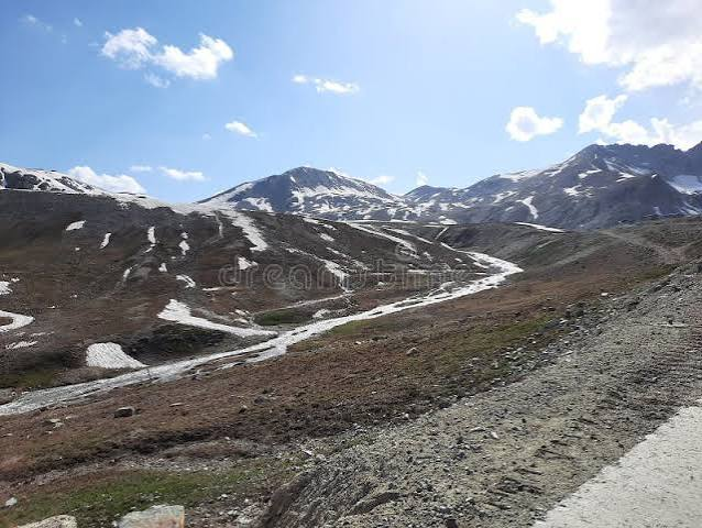
The road toward Burzil passes through high mountain terrain, so conditions can change during the travel season.
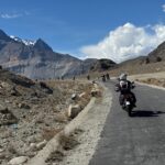
Travelers may encounter paved or improved sections as well as gravel, loose stones, water crossing the road and areas damaged by winter snow, rainfall or landslides. A high-clearance 4×4 with an experienced local driver is the most practical option for the upper route.
A good example of why current road information matters occurred on July 22, 2026. Associated Press of Pakistan reported that flash floods and heavy rainfall had closed the Astore Valley Road at several locations.
On July 29, 2026, Dawn reported that the Astore Valley Road had reopened after almost a week.
These are dated reports from July 2026. They show that road conditions can change quickly, but they should not be treated as confirmation of the road’s present condition. Travelers should always obtain a fresh road update before departure.
Best Time to Visit Burzil Pass
July and August are generally the most practical months for visiting Burzil Pass. By this time, winter snow has usually been cleared from the road and the high alpine landscape is at its greenest.
June may be possible, but winter damage and remaining snow can still affect the upper sections. September can also be a good month, particularly for photography and quieter travel, although nights become colder and early snowfall becomes more likely.
From October through spring, heavy snow can restrict or completely close the route. There is no fixed annual opening date because accessibility depends on snowfall, weather and road-clearing work.
What Is the Landscape of Burzil Like?
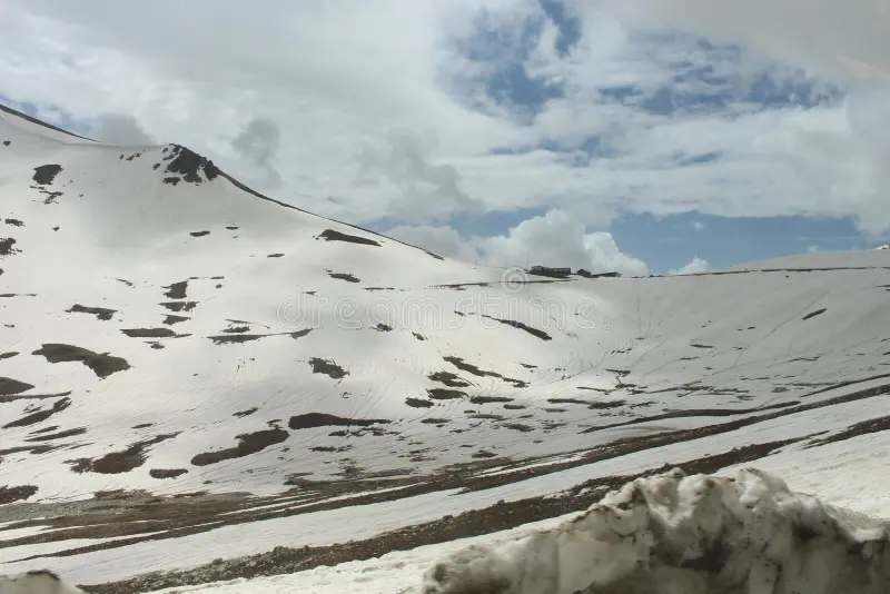
The scenery changes noticeably as the road climbs away from Astore.
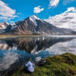
The lower valley contains villages, farmland and greener mountain slopes. Higher up, the terrain becomes more open, with alpine grasslands, streams, rocky ridges and patches of snow.
The summit area of Burzil is broad rather than narrow. GB Tourism describes the top as covered with alpine grass during summer.
After crossing toward the south, the landscape gradually changes again as the road descends toward the greener surroundings of Minimarg.
Minimarg and Domel
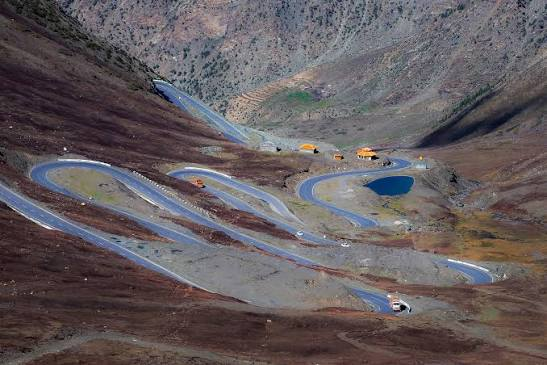
Minimarg lies beyond the pass and is known for its meadows, forests and mountain scenery. Farther into the region is Domel, another scenic part of Astore District.
The Gilgit-Baltistan Tourism Department lists Domail Rainbow Lake among the tourist attractions of Astore District.
Because Minimarg and Domel lie farther into a sensitive region, travelers should plan them separately from a straightforward visit to Burzil Top and confirm access before finalizing the trip.
Combining Burzil Pass with Deosai
Burzil combines naturally with Astore and Deosai because both routes pass through the upper Astore and Chilam area.
A practical trip could begin with Islamabad to Chilas, followed by Chilas to Astore. The next day can be used for Astore, Chilam and Burzil Pass. After visiting Burzil, travelers normally return toward Chilam.
From Chilam, the following day’s journey can take the separate route toward Deosai, Sheosar Lake and Skardu.
If Minimarg or Domel is part of the plan, allow additional time. The Burzil to Minimarg extension should not be squeezed into the same schedule unless current permissions, road conditions and travel timings make it practical.
Burzil Pass by Motorcycle
Burzil can also appeal to experienced adventure riders because of its high altitude, remote setting and changing road surfaces.
A suitable motorcycle should be properly prepared before leaving Astore. Riders should carry puncture repair equipment, basic tools, waterproof and warm riding layers, drinking water, first aid, offline navigation and sufficient fuel for remote sections.
Night riding is best avoided because road damage, loose stones, water crossings and changing weather are more difficult to judge after dark.
The same access requirements that apply to other travelers also apply to motorcycles.
Practical Travel Advice
Burzil is remote, but travelers do not need an excessive packing list.
Warm and waterproof clothing, drinking water, snacks, sunscreen, sunglasses, identification documents, cash, basic first aid, a power bank and offline maps cover most of the essentials. Fuel should be arranged before heading into the more remote parts of the route, and mobile coverage should not be relied upon throughout the journey.
Altitude also deserves attention. At 4,198 metres, some visitors may experience headache, nausea, dizziness or unusual tiredness. If symptoms become severe or continue worsening, the safest response is to descend to a lower elevation.
Photography at Burzil Pass
The road, open grasslands, snow patches, streams and surrounding ridges provide excellent landscape photography.
However, visitors should be careful around checkpoints and sensitive areas. Military installations, security personnel and restricted facilities should not be photographed.
If there is any doubt, ask before taking photographs.
Responsible Travel
Remote mountain areas are particularly vulnerable to litter and damage from vehicles.
Visitors should take rubbish back with them, keep vehicles on established tracks, avoid damaging alpine grasslands and keep streams free from plastic and other waste.
Local settlements, grazing land and livestock should also be treated with respect.
Why Visit Burzil Pass?
Burzil is interesting because its scenery and history are closely connected.
Travelers reach a high mountain pass surrounded by alpine landscapes, but they are also following part of an old route once used by couriers, officials, traders, explorers and pack animals moving between Kashmir and Gilgit.
Its location also allows Burzil to be combined with Astore and Deosai, while Minimarg and Domel can be considered where current access arrangements allow.
For travelers interested in mountain roads, history and less-visited parts of Gilgit-Baltistan, Burzil is a worthwhile addition to an Astore itinerary.
Plan Your Burzil Pass Journey
Burzil Pass is best visited with a flexible itinerary and up-to-date local information.
Before leaving Astore, confirm that the road is open, check whether your planned route requires permission and arrange suitable transport for the upper valley. If Minimarg or Domel is part of the trip, confirm access to those destinations separately rather than assuming that permission to visit Burzil Top covers the entire route.
Burzil also fits naturally into a longer journey through Astore and Deosai, giving travelers a chance to combine mountain scenery with one of the region’s most interesting historic routes.
Saiyah Travel can assist with planning an Astore, Burzil and Deosai journey, including suitable transport and checks on current local access before travel.
Frequently Asked Questions About Burzil Pass
1. Where is Burzil Pass located in Pakistan?
Burzil Pass is located in Astore District, Gilgit-Baltistan, Pakistan. It is a historic high-altitude mountain pass connecting the Astore region with areas toward Minimarg and Domel.
2. What is the elevation of Burzil Pass in feet and metres?
Burzil Pass stands at approximately 4,209 meters (13,808 ft) above sea level. Its elevation is also commonly rounded to about 4,200 metres.
3. How do you reach Burzil Pass from Astore?
The usual route from Astore follows the road through Gorikot and Chilam Chowki before continuing toward Burzil Pass. Road conditions can change with weather, so check local updates before travelling.
4. How far is Chilam Chowki from Astore?
Chilam Chowki is approximately 53 kilometres from Astore by road. Travel time depends on road conditions, weather, and the vehicle used.
5. What is the best time to visit Burzil Pass?
July and August are generally the most suitable months to plan a trip to Burzil Pass. September may also be possible depending on weather and road conditions.
6. Are the roads to Burzil Pass open, and what are the road conditions like?
Road access depends on seasonal weather, snow, and local conditions. The route can be rough, so a high-clearance 4×4 vehicle is a practical choice. Check current local road updates before setting out.
7. Can foreign tourists visit Burzil Pass in Gilgit-Baltistan?
Travel arrangements and access conditions can vary by destination and current local rules. Foreign visitors should confirm the latest travel guidance with reliable local sources before planning their journey.
8. Can you combine Burzil Pass with Deosai National Park and Skardu?
Yes, the areas can be included in a wider Gilgit-Baltistan itinerary. Travellers visiting Burzil Pass from Chilam should return to Chilam before taking the separate route toward Deosai and Skardu.
9. How long does it take to travel from Astore to Minimarg via Burzil Pass?
The journey from Astore toward Minimarg can take approximately four to five hours by jeep, depending on road and weather conditions. Allow extra time for stops and changing conditions.
10. What are the best places to visit near Burzil Pass?
Nearby destinations and areas to consider include Astore Valley, Gorikot, Chilam Chowki, Minimarg, Domel, and Deosai National Park. Check current access and road conditions when planning your route.