Rush Peak is one of the most rewarding high altitude trekking destinations in northern Pakistan. Located in Nagar District of Gilgit Baltistan within the powerful Karakoram range, Rush Peak at approximately 5,098 meters above sea level.
It is known for glacier crossings, panoramic summit views, and access to Rush Lake at 4,694 meters, one of the highest alpine lakes in the world. The trek combines natural beauty, physical challenge, and wide visibility of some of the tallest mountains on Earth.
Where is Rush Peak Located
Rush Peak is situated in Nagar Valley, Gilgit Baltistan, Pakistan. The valley lies across the Hunza River from Hunza Valley and is accessed via the famous Karakoram Highway. From Nagar, a local road leads to Hoper Village, the starting point of the trek.
Hoper Valley is known for its agricultural terraces, fruit orchards, and direct views of massive glaciers. The setting gives trekkers immediate exposure to the rugged terrain of the Karakoram.
Rush Peak Height and Elevation Clarification
Rush Peak is commonly referenced within the trekking and mountaineering community as approximately 5,098 to 5,100 meters. This figure is consistently used by regional trekking operators and guide services.
Some isolated listings mention a significantly higher elevation. However, the 5,098 meter measurement aligns more closely with practical trekking data and summit experience reports.
Below is a realistic altitude progression during the trek:
| Location | Elevation |
| Hoper Village | Approx. 2,800 m |
| Bericho Kor | Approx. 3,300 m |
| Chidin Harai | Approx. 4,400 m |
| Rush Lake | 4,694 m |
| Rush Peak Summit | 5,098 m |
At these elevations, oxygen levels drop noticeably. Gradual ascent and acclimatization days are essential.
Terrain and Glacier Crossings
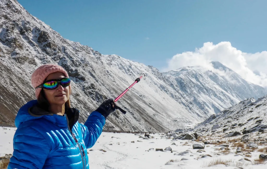
One of the defining characteristics of the Rush Peak trek is glacier travel. Trekkers cross:
- Hoper Glacier, also known as Bualtar Glacier
- Barpu Glacier
These glaciers consist of ice mixed with rock debris and moraine. Walking on glacier terrain requires balance and proper footwear. In summer, routes are generally stable, but experienced local guidance improves safety.
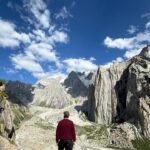
Beyond the glaciers, the trail transitions into alpine meadows and rocky slopes leading toward Rush Lake and the summit ridge.
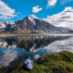
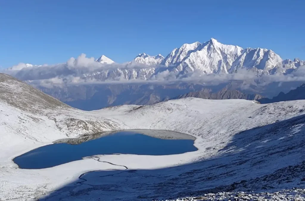
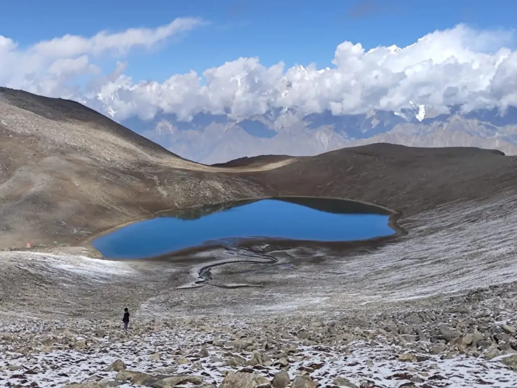
Rush Lake at 4,694 meters
Rush Lake sits at 4,694 meters and is widely considered one of the highest alpine lakes in the world. It is formed by glacial meltwater and surrounded by ridges and snow covered slopes.
The lake serves as an important acclimatization point before summit attempts. Because of its elevation, temperatures drop significantly at night even during summer months.
Clear mornings at Rush Lake often provide strong reflections of surrounding peaks. Weather conditions can shift quickly due to the exposed location.
Views from the Summit
From the summit ridge of Rush Peak, trekkers can see several major Karakoram mountains when weather conditions are clear.
These may include:
- K2
- Broad Peak
- Spantik
- Miar Peak
- Phuparash Peak
K2 appears distant and relatively small due to the long viewing distance, but on exceptionally clear days its shape is recognizable.
This wide-angle mountain visibility is one of the strongest highlights of the trek.
Difficulty Level of Rush Peak Trek

Rush Peak is classified as moderate to strenuous.
Factors contributing to difficulty include:
- Continuous elevation gain
- Steep uphill sections
- Glacier crossings
- High altitude above 4,500 meters
- Long trekking days
In summer, the summit climb is non technical and does not normally require ropes. However, good cardiovascular fitness and prior trekking experience are highly recommended.
Altitude remains the most significant challenge. Slow ascent, hydration, and rest days help reduce risks.
Best Time to Visit
The most suitable trekking months are:
- June
- July
- August
- September
During these months, glacier conditions are more manageable and heavy snowfall is absent. Even in summer, temperatures can drop below freezing at higher camps.
Winter access is limited due to snow accumulation and increased avalanche risk.
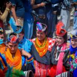
Environmental and Cultural Setting
Nagar Valley is home to small mountain communities that maintain traditional agricultural lifestyles. Fields of wheat and orchards sit below massive ice walls and rocky ridges.
The natural environment transitions rapidly with altitude. Lower sections show greenery and cultivation, while upper regions become rocky and barren due to harsh climate conditions.
Wildlife such as ibex and high altitude birds inhabit the broader Karakoram region.
Planning and Logistics
A Rush Peak trek requires careful planning including:
- Transport to Nagar Valley
- Jeep transfer to Hoper
- Camping equipment
- Food supplies
- Local experienced guides for glacier navigation
Customized Rush Peak Trek with Saiyah Travels
Saiyah Travels can customize the perfect Rush Peak trek at a reasonable price, offering an adventurous high-altitude experience led by expert local guides. The trek includes tailored itineraries, premium camping gear, personalized acclimatization support, glacier navigation assistance, and insider access to Rush Lake and panoramic summit views of K2, Broad Peak, and other Karakoram giants. Contact us to plan your ideal 2026–2027 Rush Peak adventure!
Frequently Asked Questions – Rush Peak Trek
What is the height of Rush Peak and Rush Lake?
Rush Peak rises to approximately 5,098 meters, and Rush Lake, one of the highest alpine lakes in the world, is situated at 4,694 meters in Gilgit Baltistan, Pakistan.
How difficult is the Rush Peak trek?
The trek is moderate to strenuous. Summer climbs are non-technical but require good fitness, acclimatization, and experience walking on glaciers. Winter routes are significantly harder due to snow and ice.
When is the best time to visit Rush Peak?
The ideal trekking season is from June to September. During these months, the weather is stable, glaciers are safer, and high-altitude conditions are more manageable.
Which mountains can I see from Rush Peak summit?
On clear days, trekkers can see K2, Broad Peak, Spantik, Miar Peak, and Phuparash Peak from the summit ridge of Rush Peak, offering one of the most spectacular panoramic views in the Karakoram.
What is the trekking route to Rush Peak?
The trek begins at Hoper Village in Nagar Valley, proceeds across Hoper Glacier (Bualtar Glacier) and Barpu Glacier, passes alpine meadows, reaches Rush Lake for acclimatization, and continues to the summit ridge of Rush Peak.
How long does the Rush Peak trek take?
A full Rush Peak trek typically takes 10–12 days, including acclimatization, trekking to Rush Lake, a summit attempt, and return to Hoper or Karimabad.
Do I need a guide for the Rush Peak trek?
Hiring an experienced local guide is strongly recommended. Guides help with glacier navigation, route planning, camping setup, and safety, ensuring a smoother trekking experience.
What kind of camping and accommodations are available during the trek?
Trekkers camp along the route at locations such as Bericho Kor, Chidin Harai, and Rush Lake using tents. Hotels and guesthouses are available in Hoper Village and Karimabad before and after the trek.
How should I acclimatize safely for Rush Peak?
Gradual ascent, rest days at intermediate camps, staying hydrated, and avoiding rapid elevation gain are key strategies to prevent altitude sickness.
How can Saiyah Travels help plan my Rush Peak trek?
Saiyah Travels offers customized itineraries, expert local guides, premium camping gear, transport, glacier support, and acclimatization guidance to ensure a safe and fully organized Rush Peak trekking experience.